1/5
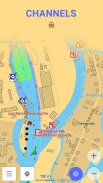
Nautical Charts — OsmAnd screenshot 0
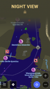
Nautical Charts — OsmAnd screenshot 1
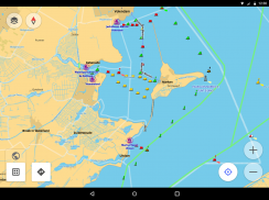
Nautical Charts — OsmAnd screenshot 2
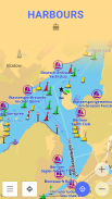
Nautical Charts — OsmAnd screenshot 3
Nautical Charts — OsmAnd screenshot 4
Nautical Charts — OsmAnd Icon

Nautical Charts — OsmAnd

OsmAnd
Trustable Ranking Icon可信任
6K+下载次数
4.5MB大小
Android Version Icon4.0.3 - 4.0.4+
Android版本
1.0(15-02-2023)最新版本
4.5
(8 评价)
Age ratingPEGI-3
如何安装
1
下载并打开安装文件
2
Unblock AptoideAptoide is a safe app! Just tap on More details and then on Install anyway.
3
完成安装并打开Aptoide
app-card-icon
详情评价版本信息
1/5

介绍 Nautical Charts — OsmAnd

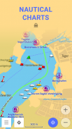
OsmAnd Nautical Charts is an extension for OsmAnd Maps & Navigation app, which is enabled starting from OsmAnd 2.0.


Usage Instructions: it is highly recommended to download nautical basemap in order to see the maps regardless of detailed map presence. Nautical charts are provided as a map and a special style, to switch style in OsmAnd please use the menu item 'Configure Map' on the map screen.


Nautical Chart is a detailed graphical representation of oceans, seas, coastal areas and rivers.


Nautical Charts are made for people who drive any kind of vehicle on water: from professional sailors to people who rented a boat to make a tour over city canals. The charts can contain various information like sailing routes, navigation lights, dangerous areas, areas where it's allowed or not allowed to sail or dock, etc.


All the professional sailors are obliged to have official nautical charts on their ships. These charts are published by authorized agencies and cost quite some money. Agencies are investing a lot in keeping the charts up to date. They release updates for the charts on regular basis, but because of the fact that reviewing the information and processing the updates takes quite some time the nautical charts are never completely up-to-date.


Nautical charts of OsmAnd are based on the data from OpenSeaMap project. The idea of the project is to build the detailed map by people how actually use it. Every user of the map can contribute by adding changes to it making it more detailed and more accurate.


While OpenSeaMap charts at the moment cannot compete with official nautical charts, they can be used by recreational sailors for orientation or route planning.


Nautical Charts — OsmAnd - 版本1.0

(15-02-2023)
其他版本
新特性* Removed icon from the application list

还没有评论或评分!要留下第一条评论或评分,请

-
8 Reviews
5
4
3
2
1
Info Trust Icon
保证非恶意应用此应用已通过病毒、恶意软件和其他恶意攻击的安全测试,不含任何威胁。

Nautical Charts — OsmAnd - APK信息

APK版本: 1.0程序包: net.osmand.nauticalPlugin
Android兼容性: 4.0.3 - 4.0.4+ (Ice Cream Sandwich)
开发商:OsmAnd权限:0
名称: Nautical Charts — OsmAnd大小: 4.5 MB下载次数: 2K版本: 1.0发布日期: 2023-10-09 14:19:50最小屏幕: SMALL支持的CPU:
程序包ID: net.osmand.nauticalPluginSHA1签名: 49:A9:AC:E0:BF:EE:7B:B9:15:06:D7:92:1F:93:A4:78:08:CB:62:AB开发商 (CN): Victor Shcherb组织 (O): OsmAnd本地 (L): Belarus国家/地区 (C): 375州/市 (ST): Minsk

Nautical Charts — OsmAnd的最新版本

1.0Trust Icon Versions
15/2/2023
2K 下载次数4.5 MB 大小

同类应用

您可能还会喜欢……